Zima (miasto)
 Stacja Zima na trasie Kolei Transsyberyjskiej. | |||||
| |||||
| Państwo | |||||
|---|---|---|---|---|---|
| Obwód | |||||
| Data założenia | |||||
| Prawa miejskie | |||||
| Burmistrz | Andriej Konowałow | ||||
| Powierzchnia | 52,85 km² | ||||
| Populacja (2011) • liczba ludności • gęstość |
| ||||
| Nr kierunkowy | +7 (39554) | ||||
| Kod pocztowy | 665393 | ||||
| Portal | |||||
Zima (ros. Зима) – miasto w Rosji w obwodzie irkuckim na Syberii na szlaku kolei transsyberyjskiej.
Założona w 1743, prawa miejskie od 1922. Ludność 32,5 tys. (2011). Ważna stacja na trasie Kolei Transsyberyjskiej, zakłady naprawy wagonów i lokomotyw. Fabryki: drewna, kalafonii, chemiczna, cegielnia.
Bibliografia
- Wielka Sowiecka Encyklopedia. Wyd. 3-e. 1969-1978 [1]
- http://www.mojgorod.ru/irkutsk_obl/zima/index.html - encyklopedia Moj Gorod.
Media użyte na tej stronie
Autor: Uwe Dedering, Licencja: CC BY-SA 3.0
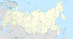
Location map of Russia.
EquiDistantConicProjection : Central parallel :
* N: 54.0° N
Central meridian :
* E: 100.0° E
Standard parallels:
* 1: 49.0° N
* 2: 59.0° N
Made with Natural Earth. Free vector and raster map data @ naturalearthdata.com.
Because the southern Kuril islands are claimed by Russia and Japan, they are shown as disputed. For more information about this see: en:Kuril Islands dispute. These islands are since 1945 under the jurisdiction of the Russian Federation.
Autor: Nzeemin, Licencja: CC BY-SA 2.0
Административная карта Иркутской области, Россия.
- Проекция: Меркатор
- Координаты для GMT: -R95.3/119.6/50.9/64.5
- Инструменты: GMT, Inkscape
Zima (Irkutsk oblast), Coats of arms
Autor: Jim Linwood, Licencja: CC BY 2.0
Zima is a town in and the administrative center of Ziminsky District of Irkutsk Oblast, Russia, situated on the intersection of the Trans-Siberian railway with the Oka River.
Zima (Irkutsk oblast), flag


