Hetton-le-Hole
(c) Oliver Dixon, CC BY-SA 2.0 | |
| Państwo | |
|---|---|
| Kraj | |
| Hrabstwo | |
| Dystrykt | |
| Populacja (2001) • liczba ludności |
|
| Nr kierunkowy | 0191 |
| Kod pocztowy | DH5 |
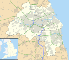
Położenie na mapie Tyne and Wear Contains Ordnance Survey data © Crown copyright and database right, CC BY-SA 3.0 | |
Położenie na mapie Wielkiej Brytanii (c) Karte: NordNordWest, Lizenz: Creative Commons by-sa-3.0 de | |
| Strona internetowa | |
| Portal | |
Hetton-le-Hole - miasto w Wielkiej Brytanii, w Anglii w hrabstwie Tyne and Wear, w dystrykcie Sunderland, położone między hrabstwem Durham a Sunderland. Miasto liczy 20 600 mieszkańców[1]
Historia
Osada założona w czasach saksońskich. W czasach nowożytnych miasto było ośrodkiem górniczym[2], rozwiniętym w XVIII wieku[3]. W dwudziestym wieku górnictwo w mieście przetrwało dzięki metodzie wydobycia George'a Stephensona. Dzięki zwiększonemu przerobowi miasto musiało wybudować ok. 200 domów[3].
Przypisy
- ↑ Demographic data (ang.). [dostęp 2008-11-11].
- ↑ Mid-ninteenth century labour moibility (ang.). [dostęp 2008-11-11].
- ↑ a b Hetton-le-Hole Interactive (ang.). [dostęp 2008-11-11]. [zarchiwizowane z tego adresu (26 września 2015)].
Media użyte na tej stronie
(c) Karte: NordNordWest, Lizenz: Creative Commons by-sa-3.0 de
Location map of the United Kingdom
Flag of England. Saint George's cross (a red cross on a white background), used as the Flag of England, the Italian city of Genoa and various other places.
Contains Ordnance Survey data © Crown copyright and database right, CC BY-SA 3.0
Map of Tyne and Wear, UK, with the following information shown:
- Administrative borders
- Coastline, lakes and rivers
- Roads and railways
- Urban areas
Equirectangular map projection on WGS 84 datum, with N/S stretched 170%
Geographic limits:
- West: 1.90W
- East: 1.30W
- North: 55.09N
- South: 54.78N
(c) Oliver Dixon, CC BY-SA 2.0
Station Road, Hetton-le-Hole On the A1052. Like so many others, the station has gone long since.


