Twist (Niemcy)
| gmina | |||||
 | |||||
| Państwo | |||||
|---|---|---|---|---|---|
| Kraj związkowy | |||||
| Powiat | |||||
| Powierzchnia | 105,61 km² | ||||
| Wysokość | 16 m n.p.m. | ||||
| Populacja (31.12.2008) • liczba ludności |
| ||||
| • gęstość | 91 os./km² | ||||
| Numer kierunkowy | 05936 | ||||
| Kod pocztowy | 49767 | ||||
| Tablice rejestracyjne | EL | ||||
Adres urzędu: Flensbergstraße 749767 Twist | |||||
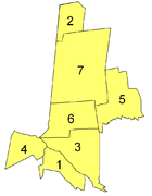
Położenie na mapie powiatu | |||||
| 52°39′N 7°06′E/52,650000 7,100000 | |||||
| Strona internetowa | |||||
| Portal | |||||
Twist - gmina samodzielna (niem. Einheitsgemeinde) w Niemczech, w kraju związkowym Dolna Saksonia, w powiecie Emsland.
Geografia
Gmina Twist położona jest bezpośrednio przy granicy z Holandią.
Dzielnice
|
Galeria
Media użyte na tej stronie
City hall of the German municipality Twist
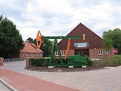
Oil pump in the German municipality Twist
Grotto in Twist (Germany)
Museum for crude oil and natural gas (Erdöl-Erdgas-Museum Twist) in Twist-Mitte
|
|
|
|
|
|
|
|
Autor: Michael Wilken, Licencja: CC BY-SA 4.0
Cormorant colony at the Internationaler Naturpark Bourtanger Moor-Bargerveen (Naturpark Moor)
Deutsch: Wappen des Landkreises Emsland. English: Coat of arms of the district de:de:Landkreis Emsland
Catholic church in the German municipality Twist (district Twist-Siedlung)
Catholic St. Georg Church in the German municipality Twist.
Commercial building in the center of the german municipality Twist
Autor: Michael Wilken, Licencja: CC BY-SA 4.0
Public indoor swimming pool in Twist (Germany)
Heimathaus Twist - Cultural center in the German municipality Twist


