Walla Walla (Waszyngton)
 Walla Walla | |||
| |||
| Państwo | |||
|---|---|---|---|
| Stan | |||
| Hrabstwo | |||
| Data założenia | 1862 | ||
| Powierzchnia | 33,2[1] km² | ||
| Populacja (2010) • liczba ludności • gęstość |
| ||
| Nr kierunkowy | 509 | ||
| Kod pocztowy | 99362 | ||
| Strona internetowa | |||
| Portal | |||
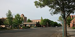
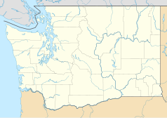
Walla Walla – miasto (city), ośrodek administracyjny hrabstwa Walla Walla, w południowo-wschodniej części stanu Waszyngton, w Stanach Zjednoczonych, położone nad rzeką Walla Walla, nieopodal granicy stanu Oregon[2]. W 2010 roku miasto liczyło 31 731 mieszkańców[1].
W latach 1836-1847 na obszarze tym, pośród plemienia Cayuse, działała misja kongregacjonalistyczna, której założycielem był amerykański lekarz i pionier Marcus Whitman. Jej działalność przerwała dokonana przez Indian masakra, w której zginęło kilkunastu osadników, w tym Whitman (tzw. masakra Whitmana)[2].
W 1856 roku założony został tutaj posterunek wojskowy, Fort Walla Walla, który stał się zaczątkiem nowej osady. Początkowo nazwane Steptoeville (na cześć podpułkownika Edwarda J. Steptoe'a, uczestnika wojen z Indianami), miasto formalnie założone zostało w 1862 roku pod obecną nazwą. W 1875 roku do miasta dotarła linia kolejowa Walla Walla and Columbia River Railroad[2].
Miasto położone jest na obszarze intensywnie wykorzystywanym rolniczo i stało się ośrodkiem przemysłu spożywczego i drzewnego[2].
Znajduje się tutaj baza Korpusu Inżynieryjnego Armii Stanów Zjednoczonych (US Army Corps of Engineers), więzienie stanowe Washington State Penitentiary oraz uczelnie Whitman College (zał. 1859), Walla Walla College (1892) i Walla Walla Community College (1967)[2].
Przypisy
- ↑ a b c Walla Walla city, Washington. QuickFacts from the US Census Bureau. [dostęp 2017-06-19]. (ang.).
- ↑ a b c d e Walla Walla, [w:] Encyclopædia Britannica [online] [dostęp 2017-06-19] (ang.).
Media użyte na tej stronie
Autor: Uwe Dedering, Licencja: CC BY-SA 3.0
Location map of the USA (without Hawaii and Alaska).
EquiDistantConicProjection:
Central parallel:
* N: 37.0° N
Central meridian:
* E: 96.0° W
Standard parallels:
* 1: 32.0° N
* 2: 42.0° N
Made with Natural Earth. Free vector and raster map data @ naturalearthdata.com.
Formulas for x and y:
x = 50.0 + 124.03149777329222 * ((1.9694462586094064-({{{2}}}* pi / 180))
      * sin(0.6010514667026994 * ({{{3}}} + 96) * pi / 180))
y = 50.0 + 1.6155950752393982 * 124.03149777329222 * 0.02613325650382181
      - 1.6155950752393982  * 124.03149777329222 *
     (1.3236744353715044  - (1.9694462586094064-({{{2}}}* pi / 180))
      * cos(0.6010514667026994 * ({{{3}}} + 96) * pi / 180))
The flag of Navassa Island is simply the United States flag. It does not have a "local" flag or "unofficial" flag; it is an uninhabited island. The version with a profile view was based on Flags of the World and as a fictional design has no status warranting a place on any Wiki. It was made up by a random person with no connection to the island, it has never flown on the island, and it has never received any sort of recognition or validation by any authority. The person quoted on that page has no authority to bestow a flag, "unofficial" or otherwise, on the island.
Autor: Alexrk2, Licencja: CC BY 3.0
Ta mapa została stworzona za pomocą GeoTools.
Flag of the city of Walla Walla
Autor: Alexrk2, Licencja: CC BY 3.0
Ta mapa została stworzona za pomocą GeoTools.
Photo of Walla Walla, Washington with the Marcus Whitman Hotel to the left.


