Salina (Kansas)
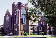
 Studio nagraniowe Blue Heaven w Salinie | |
| Państwo | |
|---|---|
| Stan | |
| Hrabstwo | |
| Burmistrz | Kaye Crawford[1] |
| Powierzchnia | 65,14 km² |
| Wysokość | 374[2] m n.p.m. |
| Populacja (2010) • liczba ludności • gęstość |
|
| Nr kierunkowy | 785 |
| Kod pocztowy | 67401, 67402 |
| Strefa czasowa | |
| Strona internetowa | |
| Portal | |
Salina – miasto w stanie Kansas, w hrabstwie Salina, położone nad rzeką Smoky Hill. Miasto liczyło w 2000 roku 45 729 mieszkańców.
Salina leży w pobliżu wzgórz Smoky Hills na Wielkich Równinach około 9,7 km na zachód od ujścia rzeki Saline do Smoky Hill. Obie te rzeki przepływają w granicach miasta wraz z dopływem Saline, strumieniem Mulberry Creek.
Miasto znajduje się w pobliżu przecięcia autostrad międzystanowych nr 70 i 135.
W Salina istnieje lotnisko z pasem startowym o długości 3750 m. Z lotniska wystartował Virgin Atlantic GlobalFlyer, na pokładzie którego Steve Fossett dokonał lotu dookoła świata bez lądowania w dniach 28 lutego 2005 - 3 marca 2005.
Siedziba diecezji rzymskokatolickiej.
Przypisy
- ↑ Council City Government (ang.). City of Salina. [dostęp 2017-10-30].
- ↑ Feature Detail Report for: Salina, Kansas (ang.). The Geographic Names Information System (GNIS). [dostęp 2017-10-30].
- ↑ Salina, Kansas Population Census 2010 and 2000 (ang.). CensusViewer. [dostęp 2017-10-30].
Media użyte na tej stronie
Autor: Uwe Dedering, Licencja: CC BY-SA 3.0
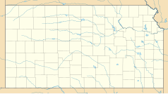
Location map of the USA (without Hawaii and Alaska).
EquiDistantConicProjection:
Central parallel:
* N: 37.0° N
Central meridian:
* E: 96.0° W
Standard parallels:
* 1: 32.0° N
* 2: 42.0° N
Made with Natural Earth. Free vector and raster map data @ naturalearthdata.com.
Formulas for x and y:
x = 50.0 + 124.03149777329222 * ((1.9694462586094064-({{{2}}}* pi / 180))
      * sin(0.6010514667026994 * ({{{3}}} + 96) * pi / 180))
y = 50.0 + 1.6155950752393982 * 124.03149777329222 * 0.02613325650382181
      - 1.6155950752393982  * 124.03149777329222 *
     (1.3236744353715044  - (1.9694462586094064-({{{2}}}* pi / 180))
      * cos(0.6010514667026994 * ({{{3}}} + 96) * pi / 180))
The flag of Navassa Island is simply the United States flag. It does not have a "local" flag or "unofficial" flag; it is an uninhabited island. The version with a profile view was based on Flags of the World and as a fictional design has no status warranting a place on any Wiki. It was made up by a random person with no connection to the island, it has never flown on the island, and it has never received any sort of recognition or validation by any authority. The person quoted on that page has no authority to bestow a flag, "unofficial" or otherwise, on the island.
The outside of Blue Heaven Studios, a recording studio in Salina, Kansas
Autor: Alexrk2, Licencja: CC BY 3.0
Ta mapa została stworzona za pomocą GeoTools.


